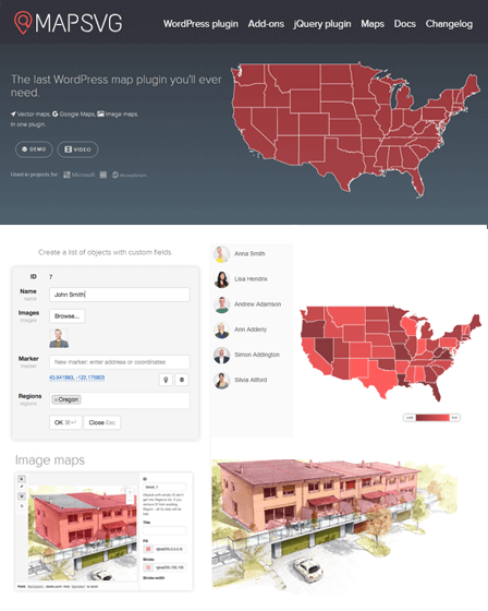
This Mapping WordPress plugin supports more than 100 countries i.e. USA, Germany, France, Spain & so on. Hence, you to create & display fully informative maps on your website for these countries.
Also, you can showcase your business or company location via maps so that, visitors can easily get your location without any hassle on a website.
Moreover, the plugin comes with excellent features such as add links in maps, disable specific regions, import or export of data & so on.
Important Features Of WordPress Mapping Plugin-
Display Tooltips
This Mapping WordPress plugin allows your users to easily identify places via tooltips whenever they put a mouse on any specific region. Also, the tooltip will display the name of that particular region.
Popup Windows
Your users will get the informative popup windows instantly on their screens when they either hover over or click via mouse on any specified area in a map.
Further, the popup window includes all the important details about that particular area along with an image.
Add Links In Maps
You can add links with special areas of a map that will redirect users in a new Google search tab. Therefore, users can easily search for the location for which they are looking for.
Highlighted Areas
With this Mapping WordPress plugin, you can highlight some areas of a map if needed, that will look colorful & eye catchy on your website.
Disable Specific Regions
The plugin allows you to disable some regions of your map. Consequently, users will not be able to see disabled locations.
Display Data With Map
With this Mapping WordPress plugin, you can display data in a map like a number of votes, average income, weather etc. along with specific regions. Also, you can highlight those areas with different shades of a color.
Create List Of Nearby States
You can build a directory that contains a complete list of nearby states, provinces or countries & display on your website.
Hence, users can click on any specific state or country in a list & easily view that location in a map.
Besides that, you can also add different custom field types in a map such as text, text area, radio, checkbox, WordPress post etc.
Add Markers
With this plugin, you add multiple markers in a map by simply entering an address of locations. Also, you can either use an already available image for markers or add your own image.
Search & Filter Option
You can provide a search option with a map so that users can easily search for nearby shops. Further, visitors can choose a state in which they want to find the desired place.
Different Map Styles
This is one of the best Mapping WordPress plugin that fully supports ‘Snazzymaps’ & allows you to easily create maps in different map styles such as Roadmap, Satellite, Terrain & Hybrid.
Fully Customizable Maps
With this plugin, you can draw your own artwork using any vector editing software & easily overlay it on Google Maps.
Further, the plugin has interactive drawing tools that you can use to create image maps & change images from raster JPEG/PNG form to normal form.
More About WordPress Mapping Plugin –
- Allows you to display full details about any user, either on the map or outside it.
- The plugin automatically positioned overlay vector maps on Google Maps.
- You can add toggles to highlight some objects in the map like parking area, labels etc.
- Easily add any functionality in maps using JavaScript codes.
- You can import a large amount of data from CSV files.
- Compatible with multiple browsers such as IE9, IE10, IE11, Firefox, Safari, Opera, Chrome, Edge & so on.
Additional Features –
- Inbuilt CSS editor
- Full Customer Support
- Detailed Documentation
- Guidance Via Video Tutorials


